Bar nearby Cafe gigls
Coronavirus disease (COVID-19) Situation
confirmed cases
6081287
deaths
22542
Austria
Bar nearby Cafe gigls
Cafe gigls
Amraser-See-Straße, 6020, Innsbruck, Innsbruck, AT Austria
contacts phone
:
+43
Latitude:
47.2632466
, Longitude:
11.4300128
larger map & directions
read more
nearest Bar
54 m
Falcone
Amraser-See-Straße 56a, Innsbruck
Bar
read more
111 m
Da Vinci Bar
Amraser-See-Straße 56a, Innsbruck
Bar
read more
289 m
Patschi Gastronomie GmbH
Bleichenweg 18, Innsbruck
Bar
read more
408 m
KT Entertainment GmbH
Etrichgasse 26, Innsbruck
Bar
read more
572 m
B1 Innsbruck
Valiergasse 15, Innsbruck
Bar
read more
781 m
Abyss Bar
Amraser-See-Straße 5, Innsbruck
Bar
read more
1.233 km
KosuLongue
Doktor-Glatz-Straße 18, Innsbruck
Bar
read more
1.233 km
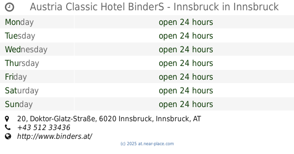
Austria Classic Hotel BinderS - Innsbruck
Doktor-Glatz-Straße 20, Innsbruck
Bar
read more
1.405 km
Karl Janesch
Defreggerstraße 37, Innsbruck
Bar
read more
1.443 km
ADMIRAL Filiale
Schützenstraße 48, Innsbruck
Bar
read more
1.478 km
Baguette
Pradler Straße 72, Innsbruck
Bar
read more
1.481 km
Monithek
Gumppstraße 15, Innsbruck
Bar
read more
1.614 km
Sportsbar Olympiahalle
Olympiastraße 10, Innsbruck
Bar
read more
1.648 km
Tiki Taka
1, Gumppstraße, Innsbruck
Bar
read more
1.657 km
Pool SHooters - Die Billard Bar in Innsbruck
Reichenauer Straße 19, Innsbruck
Bar
read more
1.696 km
Jugendheim Pradl
Reichenauer Straße 15, Innsbruck
Bar
read more
1.754 km
Cafe Bar es PaRi
Pradler Straße 5, Innsbruck
Bar
read more
1.988 km
Club Cavall
Amraser Straße 6, Innsbruck
Bar
read more
1.988 km
Tolj & Tosun GesmbH
Amraser Straße 6, Innsbruck
Bar
read more
2.001 km
Plansch café bar
Jahnstraße 37, Innsbruck
Bar
read more
2.001 km
Plansch Bar
Jahnstraße 37, Innsbruck
Bar
read more
2.038 km
The Shakespeare Pub
Ingenieur-Etzel-Straße 80, Innsbruck
Bar
read more
2.211 km
Huber Yellowstone KEG
Ingenieur-Etzel-Straße 50, Innsbruck
Bar
read more
2.47 km
Rote Laterne
Neurauthgasse 5, Innsbruck
Bar
read more
2.833 km
Culinarium in the old town
Pfarrgasse 1, Innsbruck
Bar
read more
📑
all categories
Accounting
Administrative area level 1
Administrative area level 2
Airport
Amusement park
Aquarium
Art gallery
Atm
Bakery
Bank
Bar
Beauty salon
Bicycle store
Book store
Bowling alley
Bus station
Cafe
Campground
Car dealer
Car rental
Car repair
Car wash
Casino
Cemetery
Church
City hall
Clothing store
Colloquial area
Convenience store
Country
Courthouse
Dentist
Department store
Doctor
Electrician
Electronics store
Embassy
Finance
Fire station
Florist
Food
Funeral home
Furniture store
Gas station
General contractor
Grocery or supermarket
Gym
Hair care
Hardware store
Health
Hindu Temple
Home goods store
Hospital
Insurance agency
Jewelry store
Laundry
Lawyer
Library
Light rail station
Liquor store
Local government office
Locality
Locksmith
Lodging
Meal delivery
Meal takeaway
Mosque
Movie rental
Movie theater
Moving company
Museum
Natural feature
Neighborhood
Night club
Painter
Park
Parking
Pet store
Pharmacy
Physiotherapist
Place of worship
Plumber
Point of interest
Police
Political
Post office
Premise
Real estate agency
Restaurant
Roofing contractor
Route
Rv park, camping
School
Shoe store
Shopping mall
Spa
Stadium
Storage
Store
Subpremise
Subway station
Supermarket
Synagogue
Taxi stand
Train station
Transit station
Travel agency
University
Veterinary care
Zoo
administrative area level 3
sublocality level 1
↑