Bar nearby Sky Lounge
Austria
Bar nearby Sky Lounge
Sky Lounge
Hauptstraße 34 / Lokal 3, Hauptstraße 34, Leobersdorf Austria
contacts phone
:
+43
Latitude:
47.927
, Longitude:
16.215957
read more
nearest Bar
155 m
Weinbau Zednicek
Heugasse 3, Leobersdorf
Bar
read more
169 m
Leobersdorfer Parkheuriger 19.-30.7.18
Marktplatz 7, Leobersdorf
Bar
read more
298 m
Schmankerlheuriger
Hauptstraße 53, Leobersdorf
Bar
read more
301 m
Elisabeth Fridrich
Hauptstraße 53, Leobersdorf
Bar
read more
329 m
Weinbau Johann Schlager
Heugasse 10, Leobersdorf
Bar
read more
368 m
Cocktail
2 Hauptschulplatz, Leobersdorf
Bar
read more
395 m
Heuriger Fischer
Enzesfelder Straße 16, Leobersdorf
Bar
read more
926 m
ADMIRAL Filiale
Europastraße 5, Leobersdorf
Bar
read more
930 m
Wettpunkt Admiral
Europastraße 5, Leobersdorf
Bar
read more
1.174 km
ZÖHLING Johann
Siebenhauser Platz 3, Siebenhaus
Bar
read more
1.45 km
Bunkerstüberl
Leobersdorf
Bar
read more
1.856 km
Autback
Industriegasse 2, Enzesfeld-Lindabrunn
Bar
read more
2.106 km
Café-Bar Mythos
Leobersdorfer Straße 43, Hirtenberg
Bar
read more
2.182 km
Forellenheuriger Riegler-Herber
Traubenweg, Kottingbrunn
Bar
read more
2.378 km
Weingut Routil
Feldgasse 17, Kottingbrunn
Bar
read more
2.475 km
Brunnerberghof
Wiener Neustädter Straße 27, Kottingbrunn
Bar
read more
2.477 km
Heuriger zum alten Rebstock Josef u. Maria Grabner
Wiener Neustädter Straße 27, Kottingbrunn
Bar
read more
2.821 km
Comodo
Badner Straße 9, Kottingbrunn
Bar
read more
2.89 km
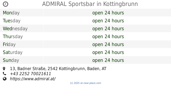
ADMIRAL Sportsbar
Badner Straße 13, Kottingbrunn
Bar
read more
2.925 km
Heurigen FIRTL Ursula
Liechtensteinstraße 18, Schönau an der Triesting
Bar
read more
3.044 km
Karl Otmar u Roswitha
Braungasse 6, Schönau an der Triesting
Bar
read more
3.891 km
Heuriger Schneller
Wiener Straße 18, Sollenau
Bar
read more
4.245 km
Karl Lielacher
Hauptstraße 71
Bar
read more
4.483 km
Radler Treff Bad Vöslau
Flugfeldstraße 40, Bad Vöslau
Bar
read more
5.208 km
Heurigen tavern Elke and Christian Putz
Hauptstraße 25, Teesdorf
Bar
read more
📑
all categories
Accounting
Administrative area level 1
Administrative area level 2
Airport
Amusement park
Aquarium
Art gallery
Atm
Bakery
Bank
Bar
Beauty salon
Bicycle store
Book store
Bowling alley
Bus station
Cafe
Campground
Car dealer
Car rental
Car repair
Car wash
Casino
Cemetery
Church
City hall
Clothing store
Colloquial area
Convenience store
Country
Courthouse
Dentist
Department store
Doctor
Electrician
Electronics store
Embassy
Finance
Fire station
Florist
Food
Funeral home
Furniture store
Gas station
General contractor
Grocery or supermarket
Gym
Hair care
Hardware store
Health
Hindu Temple
Home goods store
Hospital
Insurance agency
Jewelry store
Laundry
Lawyer
Library
Light rail station
Liquor store
Local government office
Locality
Locksmith
Lodging
Meal delivery
Meal takeaway
Mosque
Movie rental
Movie theater
Moving company
Museum
Natural feature
Neighborhood
Night club
Painter
Park
Parking
Pet store
Pharmacy
Physiotherapist
Place of worship
Plumber
Point of interest
Police
Political
Post office
Premise
Real estate agency
Restaurant
Roofing contractor
Route
Rv park, camping
School
Shoe store
Shopping mall
Spa
Stadium
Storage
Store
Subpremise
Subway station
Supermarket
Synagogue
Taxi stand
Train station
Transit station
Travel agency
University
Veterinary care
Zoo
administrative area level 3
sublocality level 1
↑