Gas station nearby Eni
Coronavirus disease (COVID-19) Situation
confirmed cases
6081287
deaths
22542
Austria
Gas station nearby Eni
Eni
Bersbuch 401, Andelsbuch Ausztria
contacts phone
:
+43
Latitude:
47.398036
, Longitude:
9.8536551
read more
nearest Gas station
6.928 km
Johann Meusburger GmbH
Zeihenbühl 396, Lingenau
Gas station
read more
8.871 km
DISK Tankstelle
Arlbergstraße 6, Dornbirn
Gas station
read more
9.251 km
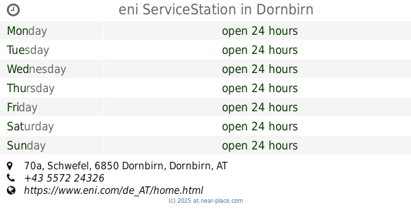
eni ServiceStation
Schwefel 70a, Dornbirn
Gas station
read more
9.587 km
VEG
Höchsterstraße 42, Dornbirn
Gas station
read more
9.694 km
OMV Tankstelle
Dornbirner Straße 22, Wolfurt
Gas station
read more
10.105 km
Eni
Lustenauer Straße 52, Dornbirn
Gas station
read more
10.495 km
Shell
Lustenauer Straße 86, Dornbirn
Gas station
read more
13.47 km
OMV Tankstelle
Arlbergstraße 135, Bregenz
Gas station
read more
13.53 km
BP Tankstelle Manfred Beer
Lustenauer Straße 112a, Hohenems
Gas station
read more
13.614 km
JET Tankstelle
Kaiser Fr.Josef-Str. 40, Hohenems
Gas station
read more
14.081 km
Agip
Arlbergstraße 54, Bregenz
Gas station
read more
14.16 km
BP
Arlbergstraße 63, Bregenz
Gas station
read more
14.22 km
Diskont Tankstelle
Barnabas-Fink-Straße 1, Hohenems
Gas station
read more
14.42 km
Eni
Rheinstraße 4, Bregenz
Gas station
read more
14.867 km
Robert Schwarzbauer
Grindelstraße 14, Lustenau
Gas station
read more
14.994 km
Eni Service Station
Maria-Theresien-Straße 14, Lustenau
Gas station
read more
15.186 km
Shell
A14, Hohenems
Gas station
read more
15.253 km
OMV Tankstelle
Rheinstraße 24, Hard
Gas station
read more
15.295 km
DISK Tankstelle
Bauern 6, Altach
Gas station
read more
15.295 km
Avanti Tankstelle
Bauern 6, Altach
Gas station
read more
15.297 km
Avanti Tankstelle
Hofsteigstraße 85, Hard
Gas station
read more
15.802 km
JET Tankstelle
Rheinstraße 99, Hard
Gas station
read more
15.973 km
JET Tankstelle
Lustenauer Straße 2, Götzis
Gas station
read more
16.589 km
BP
Harder Straße 84, Fußach
Gas station
read more
16.594 km
BP Tankstelle Maehr Ernst
Harder Straße 84, Fußach
Gas station
read more
📑
all categories
Accounting
Administrative area level 1
Administrative area level 2
Airport
Amusement park
Aquarium
Art gallery
Atm
Bakery
Bank
Bar
Beauty salon
Bicycle store
Book store
Bowling alley
Bus station
Cafe
Campground
Car dealer
Car rental
Car repair
Car wash
Casino
Cemetery
Church
City hall
Clothing store
Colloquial area
Convenience store
Country
Courthouse
Dentist
Department store
Doctor
Electrician
Electronics store
Embassy
Finance
Fire station
Florist
Food
Funeral home
Furniture store
Gas station
General contractor
Grocery or supermarket
Gym
Hair care
Hardware store
Health
Hindu Temple
Home goods store
Hospital
Insurance agency
Jewelry store
Laundry
Lawyer
Library
Light rail station
Liquor store
Local government office
Locality
Locksmith
Lodging
Meal delivery
Meal takeaway
Mosque
Movie rental
Movie theater
Moving company
Museum
Natural feature
Neighborhood
Night club
Painter
Park
Parking
Pet store
Pharmacy
Physiotherapist
Place of worship
Plumber
Point of interest
Police
Political
Post office
Premise
Real estate agency
Restaurant
Roofing contractor
Route
Rv park, camping
School
Shoe store
Shopping mall
Spa
Stadium
Storage
Store
Subpremise
Subway station
Supermarket
Synagogue
Taxi stand
Train station
Transit station
Travel agency
University
Veterinary care
Zoo
administrative area level 3
sublocality level 1
↑