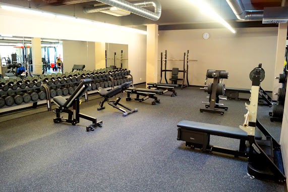
Gym nearby Fitnesscenter Rabengasse
Coronavirus disease (COVID-19) Situation
confirmed cases
6081287
deaths
22542
Austria
Gym nearby Fitnesscenter Rabengasse
Fitnesscenter Rabengasse
Rabengasse 13, Wien Österreich
contacts phone
:
+43
Latitude:
48.1947479
, Longitude:
16.3985175
read more
nearest Gym
322 m
USI Sportstätte Rennweg
Wien
Gym
read more
333 m
Fit-mit-Elvira
Schimmelgasse 3, Wien
Gym
read more
395 m
Jana Thann
Kaisergartengasse 1A, Wien
Gym
read more
482 m
HyperActive Training
Apostelgasse 18, Wien
Gym
read more
521 m
Thaimaniac Gym
Barichgasse 14, Wien
Gym
read more
670 m
FitInn
Dietrichgasse 25, Wien
Gym
read more
671 m
Fit In
Dietrichgasse 25, Wien
Gym
read more
742 m
clever fit
Markhofgasse 15-17, Wien
Gym
read more
776 m
euroGYM FITNESSSTUDIO
Landstraßer Hauptstraße 71, Wien
Gym
read more
777 m
Beau Well Dreams 1030 Wien
Landstraßer Hauptstraße 71, Wien
Gym
read more
778 m
Mrs.Sporty Club Wien Landstraße
Dapontegasse 4, Wien
Gym
read more
805 m
HCK Fitness
Schlachthausgasse 3, Wien
Gym
read more
812 m
euroGYM
Landstraßer Hauptstraße 71, Wien
Gym
read more
812 m
euroGYM
Landstraßer Hauptstraße 71/2, Wien
Gym
read more
824 m
SHINMU
Dapontegasse 8, Wien
Gym
read more
911 m
INJOY Fitness- und Wellnessclub Wien
Schnirchgasse 12, Wien
Gym
read more
911 m
INJOY Health Club Wien
Schnirchgasse 12, Wien
Gym
read more
915 m
Stars Fitness GmbH
Rennweg 33B, Wien
Gym
read more
924 m
EuroGYM
Ungargasse 60, Wien
Gym
read more
929 m
Pilates Studio Vienna
Kundmanngasse 33, Wien
Gym
read more
975 m
Fitness Point Vienna
Baumgasse 87, Wien
Gym
read more
982 m
Asylantencurbs
Erdbergstraße 186-190, Wien
Gym
read more
991 m
Garage Gym
Ungargasse 46, Wien
Gym
read more
1000 m
Bodystreet Wien-Rochusmarkt
Ungargasse 46, Wien
Gym
read more
1.018 km
CrossFit Vienna The Starship
Rennweg 97, Wien
Gym
read more
📑
all categories
Accounting
Administrative area level 1
Administrative area level 2
Airport
Amusement park
Aquarium
Art gallery
Atm
Bakery
Bank
Bar
Beauty salon
Bicycle store
Book store
Bowling alley
Bus station
Cafe
Campground
Car dealer
Car rental
Car repair
Car wash
Casino
Cemetery
Church
City hall
Clothing store
Colloquial area
Convenience store
Country
Courthouse
Dentist
Department store
Doctor
Electrician
Electronics store
Embassy
Finance
Fire station
Florist
Food
Funeral home
Furniture store
Gas station
General contractor
Grocery or supermarket
Gym
Hair care
Hardware store
Health
Hindu Temple
Home goods store
Hospital
Insurance agency
Jewelry store
Laundry
Lawyer
Library
Light rail station
Liquor store
Local government office
Locality
Locksmith
Lodging
Meal delivery
Meal takeaway
Mosque
Movie rental
Movie theater
Moving company
Museum
Natural feature
Neighborhood
Night club
Painter
Park
Parking
Pet store
Pharmacy
Physiotherapist
Place of worship
Plumber
Point of interest
Police
Political
Post office
Premise
Real estate agency
Restaurant
Roofing contractor
Route
Rv park, camping
School
Shoe store
Shopping mall
Spa
Stadium
Storage
Store
Subpremise
Subway station
Supermarket
Synagogue
Taxi stand
Train station
Transit station
Travel agency
University
Veterinary care
Zoo
administrative area level 3
sublocality level 1
↑