Park nearby ARCHE NOAH Schaugarten
Coronavirus disease (COVID-19) Situation
confirmed cases
6081287
deaths
22542
Austria
Park nearby ARCHE NOAH Schaugarten
ARCHE NOAH Schaugarten
Obere Straße 40 A Österreich
contacts phone
:
+43
Latitude:
48.5199626
, Longitude:
15.6176229
read more
nearest Park
6.722 km
Weinweg Langenlois
Kamptalstraße 3, Langenlois
Park
read more
6.79 km
Maria Immaculata Brunnen
Holzplatz 7, Langenlois
Park
read more
7.443 km
3 Teiche
Park
read more
8.867 km
Kurpark Gars am Kamp
Gars am Kamp
Park
read more
9.61 km
Schuberth Park
Wassergasse 643, Gars am Kamp
Park
read more
10.041 km
"Heimliches Gericht", ein bekanntes Wanderziel
Senftenberg
Park
read more
11.146 km
Rudolf Docekal
Diendorfer Weg 14, Hadersdorf am Kamp
Park
read more
11.19 km
Schmitt Park
Krems an der Donau
Park
read more
11.586 km
Dörr-Garten Alt
Friedhofstraße, Krems an der Donau
Park
read more
12.155 km
Ödes Schloss Westflügel
Kamptal Straße 140, Rosenburg
Park
read more
12.565 km
Brunnen im Stadtpark
Ringstraße 3159/1, Krems an der Donau
Park
read more
12.587 km
Stadt Park
Utzstraße 13, Krems an der Donau
Park
read more
12.906 km
Karl-Tiefenbacher Park
Krems an der Donau
Park
read more
12.919 km
Waldlehrpfad
Schreckberg 3500, Krems an der Donau
Park
read more
13.212 km
KreativWanderungem41
Steiner Donaulände 49, Krems an der Donau
Park
read more
14.481 km
Schubertpark
Mautern an der Donau
Park
read more
14.481 km
Schubert Park
Mautern an der Donau
Park
read more
15.529 km
Wanderoute
Baumgarten 26, Mautern an der Donau
Park
read more
15.642 km
Franzosendenkmal
Oberloiben 58, Dürnstein
Park
read more
15.799 km
Wotansfelsen
Felling
Park
read more
16.1 km
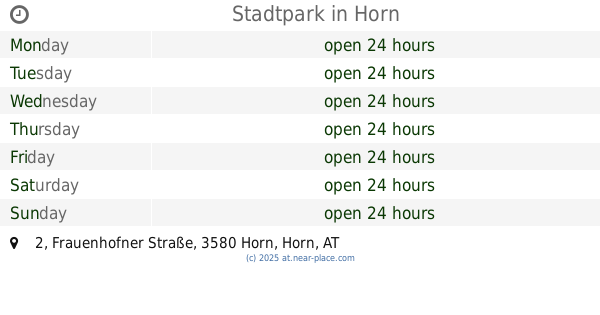
Stadtpark
Frauenhofner Straße 2, Horn
Park
read more
16.944 km
MPW_Pflanzenzuchttechnik-Shop
Großmotten 16, Großmotten
Park
read more
18.145 km
Mammutbäume Parkplatz
Bruckweg, Paudorf
Park
read more
18.472 km
Maigen Mühle
Gemeinde, Albrechtsberg an der Großen Krems
Park
read more
20.075 km
Freizeitanlage Brunn an der Wild
Österreich, Industriestraße 11, Brunn an der Wild
Park
read more
📑
all categories
Accounting
Administrative area level 1
Administrative area level 2
Airport
Amusement park
Aquarium
Art gallery
Atm
Bakery
Bank
Bar
Beauty salon
Bicycle store
Book store
Bowling alley
Bus station
Cafe
Campground
Car dealer
Car rental
Car repair
Car wash
Casino
Cemetery
Church
City hall
Clothing store
Colloquial area
Convenience store
Country
Courthouse
Dentist
Department store
Doctor
Electrician
Electronics store
Embassy
Finance
Fire station
Florist
Food
Funeral home
Furniture store
Gas station
General contractor
Grocery or supermarket
Gym
Hair care
Hardware store
Health
Hindu Temple
Home goods store
Hospital
Insurance agency
Jewelry store
Laundry
Lawyer
Library
Light rail station
Liquor store
Local government office
Locality
Locksmith
Lodging
Meal delivery
Meal takeaway
Mosque
Movie rental
Movie theater
Moving company
Museum
Natural feature
Neighborhood
Night club
Painter
Park
Parking
Pet store
Pharmacy
Physiotherapist
Place of worship
Plumber
Point of interest
Police
Political
Post office
Premise
Real estate agency
Restaurant
Roofing contractor
Route
Rv park, camping
School
Shoe store
Shopping mall
Spa
Stadium
Storage
Store
Subpremise
Subway station
Supermarket
Synagogue
Taxi stand
Train station
Transit station
Travel agency
University
Veterinary care
Zoo
administrative area level 3
sublocality level 1
↑