Subpremise nearby Postbriefkasten
Coronavirus disease (COVID-19) Situation
confirmed cases
6081287
deaths
22542
Austria
Subpremise nearby Postbriefkasten
Postbriefkasten
Leondinger Straße 2, Sankt Martin im Mühlkreis Østrig
contacts phone
:
+43
Latitude:
48.2448779
, Longitude:
14.2596037
read more
nearest Subpremise
614 m
Postbriefkasten
Stifterstraße 2
Subpremise
read more
907 m
Postbriefkasten
Oberhaidstraße 19
Subpremise
read more
1.018 km
Postbriefkasten
Bahnhofstraße 62, Sankt Dionysen
Subpremise
read more
1.218 km
Postbriefkasten
Weidfeldstraße 174, Traun
Subpremise
read more
1.249 km
Postbriefkasten
Prinz-Eugen-Straße 47, Langholzfeld
Subpremise
read more
1.624 km
Postbriefkasten
Netzwerkplatz 1, Langholzfeld
Subpremise
read more
1.713 km
Postbriefkasten
Plus-Kauf-Straße 7
Subpremise
read more
1.955 km
Postbriefkasten
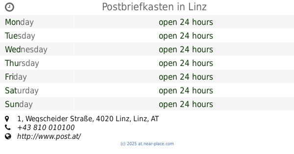
Wegscheider Straße 1, Linz
Subpremise
read more
2.124 km
Postbriefkasten
Dieselstraße 4, Linz
Subpremise
read more
2.189 km
Postbriefkasten
Sankt Isidor 16
Subpremise
read more
2.309 km
Postbriefkasten
Wegscheider Straße 124, Hart
Subpremise
read more
2.338 km
Postbriefkasten
Winetzhammerstraße 6, Linz
Subpremise
read more
2.508 km
Postbriefkasten
Flötzerweg 95-97, Linz
Subpremise
read more
2.511 km
Postbriefkasten
Haiderstraße 5a, Linz
Subpremise
read more
2.512 km
Postbriefkasten
Waggerlstraße 2
Subpremise
read more
2.571 km
Postbriefkasten
Limesstraße 31, Reith
Subpremise
read more
2.66 km
Postbriefkasten
Welser Straße 35, Hart
Subpremise
read more
2.699 km
Postbriefkasten
Bahnhofstraße 42, Traun
Subpremise
read more
2.844 km
Postbriefkasten
Europastraße 12, Linz
Subpremise
read more
3.369 km
Postbriefkasten
Landwiedstraße 65, Linz
Subpremise
read more
3.637 km
Postbriefkasten
Wüstenrotplatz 2, Linz
Subpremise
read more
3.676 km
Postbriefkasten
Mitterfeldstraße 101, Traun
Subpremise
read more
3.797 km
Postbriefkasten
Stadlerstraße 8, Linz
Subpremise
read more
4.076 km
Postbriefkasten
Glimpfingerstraße 94, Linz
Subpremise
read more
4.966 km
Postbriefkasten
Traunerstraße 81, Oedt
Subpremise
read more
📑
all categories
Accounting
Administrative area level 1
Administrative area level 2
Airport
Amusement park
Aquarium
Art gallery
Atm
Bakery
Bank
Bar
Beauty salon
Bicycle store
Book store
Bowling alley
Bus station
Cafe
Campground
Car dealer
Car rental
Car repair
Car wash
Casino
Cemetery
Church
City hall
Clothing store
Colloquial area
Convenience store
Country
Courthouse
Dentist
Department store
Doctor
Electrician
Electronics store
Embassy
Finance
Fire station
Florist
Food
Funeral home
Furniture store
Gas station
General contractor
Grocery or supermarket
Gym
Hair care
Hardware store
Health
Hindu Temple
Home goods store
Hospital
Insurance agency
Jewelry store
Laundry
Lawyer
Library
Light rail station
Liquor store
Local government office
Locality
Locksmith
Lodging
Meal delivery
Meal takeaway
Mosque
Movie rental
Movie theater
Moving company
Museum
Natural feature
Neighborhood
Night club
Painter
Park
Parking
Pet store
Pharmacy
Physiotherapist
Place of worship
Plumber
Point of interest
Police
Political
Post office
Premise
Real estate agency
Restaurant
Roofing contractor
Route
Rv park, camping
School
Shoe store
Shopping mall
Spa
Stadium
Storage
Store
Subpremise
Subway station
Supermarket
Synagogue
Taxi stand
Train station
Transit station
Travel agency
University
Veterinary care
Zoo
administrative area level 3
sublocality level 1
↑