Airport nearby Hubschrauberlandeplatz Bundesamtsgebäude Josef-Holaubek-Platz
Austria
Airport nearby Hubschrauberlandeplatz Bundesamtsgebäude Josef-Holaubek-Platz
Hubschrauberlandeplatz Bundesamtsgebäude Josef-Holaubek-Platz
Josef-Holaubek-Platz 1, Wien Österreich
contacts phone
:
+43
Latitude:
48.2344168
, Longitude:
16.3571549
read more
nearest Airport
1.658 km
Hubschrauberlandeplatz
Währinger Gürtel 18-20, Wien
Airport
read more
1.994 km
Helipad
Vienna
Airport
read more
1.994 km
Helipad
Wien
Airport
read more
2.194 km
Heliport LPD Wien
Schottenring 7-9, Wien
Airport
read more
3.724 km
Air Malta p.l.c.
Opernring 1, Wien
Airport
read more
4.103 km
Hoher Platz
Cobenzlgasse 111-73, Wien
Airport
read more
4.537 km
Airport Service Vienna, airport taxi, minibus service
Wehrgasse 11, Wien
Airport
read more
4.537 km
Airportservice in Wien seit über 25 Jahren - Telefon: 0043 676 351 64 20
Wehrgasse 11, Wien
Airport
read more
4.539 km
Ilse Ernst - Airportservice in Wien seit über 25 Jahren !
9, Wehrgasse, Wien
Airport
read more
4.913 km
Helipad
Johann-Staud-Straße 1, Wien
Airport
read more
4.967 km
Helipad
Boerhaavegasse 8A, Wien
Airport
read more
5.568 km
Wiener Luftfahrerverband
Hauslabgasse 24, Wien
Airport
read more
6.883 km
Helipad UKH Meidling
Vienna
Airport
read more
6.914 km
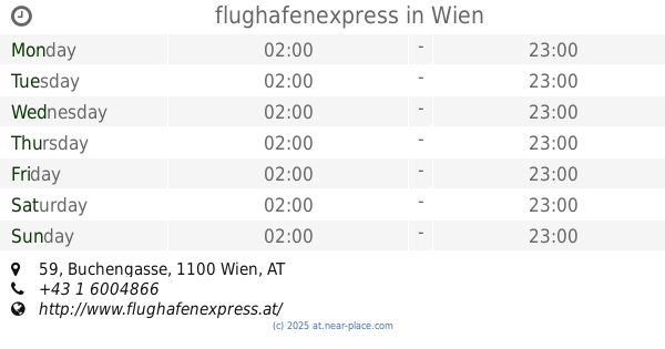
flughafenexpress
Buchengasse 59, Wien
Airport
read more
7.436 km
Trinitas Airport Transfer
Sedlitzkygasse 4, Wien
Airport
read more
8.196 km
Helipad
Kapellenweg 37, Wien
Airport
read more
8.278 km
Vienna Aviation | Photography | Spotting | Flugzeug Fotos
Stegmayergasse 96, Wien
Airport
read more
8.281 km
Vienna Cab2Airport
Breitenfurter Straße 107, Wien
Airport
read more
17.628 km
VIP & General Aviation Terminal
Steinriegelweg, Wien-Flughafen
Airport
read more
17.63 km
Vienna Aircraft Handling, FBO
Objekt 140, Steinriegelweg, Wien-Flughafen
Airport
read more
17.659 km
Priority Terminal
Airport
read more
18.738 km
SkyXS Aircargo GmbH
Objekt 262 Eingang 5, Flughafen
Airport
read more
19.543 km
C Gates
Airport
read more
22.983 km
Flugplatz Stockerau
Senningerstraße 390/2, Stockerau
Airport
read more
23.036 km
Aerial - Reidinger Helicopter GmbH FTO Flugschule
Senningerstraße 59, Stockerau
Airport
read more
📑
all categories
Accounting
Administrative area level 1
Administrative area level 2
Airport
Amusement park
Aquarium
Art gallery
Atm
Bakery
Bank
Bar
Beauty salon
Bicycle store
Book store
Bowling alley
Bus station
Cafe
Campground
Car dealer
Car rental
Car repair
Car wash
Casino
Cemetery
Church
City hall
Clothing store
Colloquial area
Convenience store
Country
Courthouse
Dentist
Department store
Doctor
Electrician
Electronics store
Embassy
Finance
Fire station
Florist
Food
Funeral home
Furniture store
Gas station
General contractor
Grocery or supermarket
Gym
Hair care
Hardware store
Health
Hindu Temple
Home goods store
Hospital
Insurance agency
Jewelry store
Laundry
Lawyer
Library
Light rail station
Liquor store
Local government office
Locality
Locksmith
Lodging
Meal delivery
Meal takeaway
Mosque
Movie rental
Movie theater
Moving company
Museum
Natural feature
Neighborhood
Night club
Painter
Park
Parking
Pet store
Pharmacy
Physiotherapist
Place of worship
Plumber
Point of interest
Police
Political
Post office
Premise
Real estate agency
Restaurant
Roofing contractor
Route
Rv park, camping
School
Shoe store
Shopping mall
Spa
Stadium
Storage
Store
Subpremise
Subway station
Supermarket
Synagogue
Taxi stand
Train station
Transit station
Travel agency
University
Veterinary care
Zoo
administrative area level 3
sublocality level 1
↑