Cafe nearby Eva Lasinger
Austria
Cafe nearby Eva Lasinger
Eva Lasinger
Nestroystraße 4, Linz Austria
contacts phone
:
+43
Latitude:
48.3166665
, Longitude:
14.2828093
read more
nearest Cafe
74 m
Café-Pub Gloria
Freistädter Straße 27, Linz
Cafe
read more
217 m
Urfahranerl
Peuerbachstraße 9, Linz
Cafe
read more
219 m
Cafe Giuliano
Blütenstraße, Linz
Cafe
read more
223 m
Cafe EH
Hauptplatz 70, Linz
Cafe
read more
223 m
Meisinger OEG
Hauptstraße 70, Linz
Cafe
read more
229 m
Cafe Eh
Hauptstraße 70, Linz
Cafe
read more
258 m
Konditoreicafe Jindrak
Blütenstraße 11, Linz
Cafe
read more
258 m
Konditorei Jindrak | Filiale Lentia City
Blütenstraße 11, Linz
Cafe
read more
272 m
Hasenstall
Hauptstraße 62, Linz
Cafe
read more
279 m
Inge's Bio Cafe
Hauptstraße 71, Linz
Cafe
read more
327 m
WINWIN Linz-Urfahr
Hauptstraße 63, Linz
Cafe
read more
351 m
Feenwolke & Zuckerguss
Hauptstraße 59, Linz
Cafe
read more
374 m
Mein Café Hofbauer
Hauptstraße 46, Linz
Cafe
read more
429 m
Blue Pub Cafe
Freistädter Straße 62, Linz
Cafe
read more
452 m
Cafe Plank
Hauptstraße 47, Linz
Cafe
read more
484 m
Josef Küblböck
Wildbergstraße 6, Linz
Cafe
read more
538 m
Espressostube Kastner
Ferihumerstraße 44, Linz
Cafe
read more
597 m
Helene Schaurecker
Urfahrmarkt 1, Linz
Cafe
read more
611 m
Josef Ruscic
Schulstraße 9, Linz
Cafe
read more
766 m
Segafredo
Lentia City, Hauptstraße, 4040, Linz
Cafe
read more
901 m
Cafe URFA
Freistädter Straße 123, Linz
Cafe
read more
1.001 km
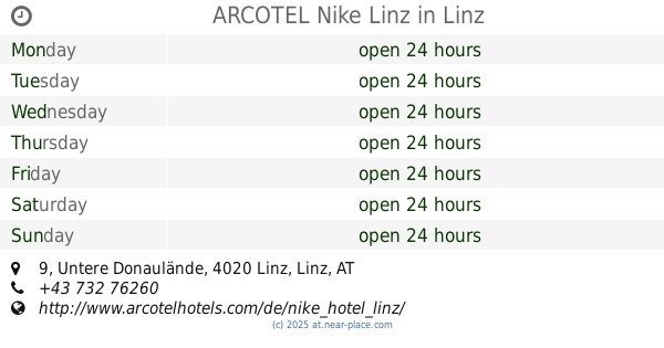
ARCOTEL Nike Linz
Untere Donaulände 9, Linz
Cafe
read more
1.011 km
Karin Lechner
Untere Donaulände 7, Linz
Cafe
read more
1.164 km
Cafe Marco Polo
Fabrikstraße 16, Linz
Cafe
read more
1.196 km
Lüfti Cafe-Bar
Lüfteneggerstraße 4, Linz
Cafe
read more
📑
all categories
Accounting
Administrative area level 1
Administrative area level 2
Airport
Amusement park
Aquarium
Art gallery
Atm
Bakery
Bank
Bar
Beauty salon
Bicycle store
Book store
Bowling alley
Bus station
Cafe
Campground
Car dealer
Car rental
Car repair
Car wash
Casino
Cemetery
Church
City hall
Clothing store
Colloquial area
Convenience store
Country
Courthouse
Dentist
Department store
Doctor
Electrician
Electronics store
Embassy
Finance
Fire station
Florist
Food
Funeral home
Furniture store
Gas station
General contractor
Grocery or supermarket
Gym
Hair care
Hardware store
Health
Hindu Temple
Home goods store
Hospital
Insurance agency
Jewelry store
Laundry
Lawyer
Library
Light rail station
Liquor store
Local government office
Locality
Locksmith
Lodging
Meal delivery
Meal takeaway
Mosque
Movie rental
Movie theater
Moving company
Museum
Natural feature
Neighborhood
Night club
Painter
Park
Parking
Pet store
Pharmacy
Physiotherapist
Place of worship
Plumber
Point of interest
Police
Political
Post office
Premise
Real estate agency
Restaurant
Roofing contractor
Route
Rv park, camping
School
Shoe store
Shopping mall
Spa
Stadium
Storage
Store
Subpremise
Subway station
Supermarket
Synagogue
Taxi stand
Train station
Transit station
Travel agency
University
Veterinary care
Zoo
administrative area level 3
sublocality level 1
↑