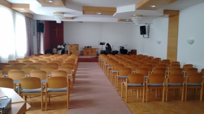
Church nearby Schloßkapelle Leombach
Austria
Church nearby Schloßkapelle Leombach
Schloßkapelle Leombach
Sipbachzell Austria
contacts phone
:
+43
Latitude:
48.125441
, Longitude:
14.0932755
read more
nearest Church
1.566 km
Blindenmarktkapelle
Blindenmarkt 6, Schleißheim
Church
read more
3.352 km
Pfarramt Sipbachzell
Am Pfarrberg 2, Sipbachzell
Church
read more
3.352 km
Pfarrkirche Sipbachzell
Sipbachzell
Church
read more
3.698 km
Schlosskapelle
Schlossgasse 1, Schleißheim
Church
read more
4.122 km
Pfarramt
Kirchengasse 1, Schleißheim
Church
read more
4.129 km
Pfarrkirche Schleißheim
Kirchengasse 6, Schleißheim
Church
read more
4.392 km
Ortbauernkapelle
Sattledt
Church
read more
4.491 km
Heidledterkapelle
Sattledt
Church
read more
4.542 km
Hubertus-Kapelle
Weißkirchen an der Traun
Church
read more
4.6 km
Hansfischer-Kapelle
Weißkirchen an der Traun
Church
read more
4.925 km
Pfarre Weißkirchen bei Wels
Pfarrplatz 1
Church
read more
5.002 km
Pfarrkirche Weißkirchen
Pfarrplatz 2, Weißkirchen an der Traun
Church
read more
5.015 km
Pfarrkirche Thalheim
Thalheim bei Wels
Church
read more
5.055 km
Pfarre Thalheim
Kirchenstraße 2, Thalheim bei Wels
Church
read more
5.446 km
Illi-Kapelle
Weißkirchen an der Traun
Church
read more
5.501 km
Kapelle bei Köttstorfer in Graßing
Weißkirchen an der Traun
Church
read more
5.562 km
Aegidi Kirche
Sankt Ägydiweg 331/1, Thalheim bei Wels
Church
read more
5.614 km
Pfarrkirche Wels-Pernau
Haidlweg 58, Wels
Church
read more
6.036 km
Mennonitische Freikirche Wels
August-Göllerich-Str. 3a, Wels
Church
read more
6.039 km
Advent-Mission
August-Göllerich-Straße 3a, Wels
Church
read more
6.075 km
Stadtpfarramt Wels
Stadtplatz 31, Wels
Church
read more
6.1 km
Kirchenbeitragsstelle
Herrengasse 2, Wels
Church
read more
6.1 km
Stadtpfarrkirche
Pfarrgasse 27, Wels
Church
read more
6.132 km
Marienkirche
Herrengasse 2, Wels
Church
read more
15.849 km
Pfarrkirche Wimsbach
Bad Wimsbach-Neydharting
Church
read more
📑
all categories
Accounting
Administrative area level 1
Administrative area level 2
Airport
Amusement park
Aquarium
Art gallery
Atm
Bakery
Bank
Bar
Beauty salon
Bicycle store
Book store
Bowling alley
Bus station
Cafe
Campground
Car dealer
Car rental
Car repair
Car wash
Casino
Cemetery
Church
City hall
Clothing store
Colloquial area
Convenience store
Country
Courthouse
Dentist
Department store
Doctor
Electrician
Electronics store
Embassy
Finance
Fire station
Florist
Food
Funeral home
Furniture store
Gas station
General contractor
Grocery or supermarket
Gym
Hair care
Hardware store
Health
Hindu Temple
Home goods store
Hospital
Insurance agency
Jewelry store
Laundry
Lawyer
Library
Light rail station
Liquor store
Local government office
Locality
Locksmith
Lodging
Meal delivery
Meal takeaway
Mosque
Movie rental
Movie theater
Moving company
Museum
Natural feature
Neighborhood
Night club
Painter
Park
Parking
Pet store
Pharmacy
Physiotherapist
Place of worship
Plumber
Point of interest
Police
Political
Post office
Premise
Real estate agency
Restaurant
Roofing contractor
Route
Rv park, camping
School
Shoe store
Shopping mall
Spa
Stadium
Storage
Store
Subpremise
Subway station
Supermarket
Synagogue
Taxi stand
Train station
Transit station
Travel agency
University
Veterinary care
Zoo
administrative area level 3
sublocality level 1
↑