Lodging nearby Gasthof Waldheim
Austria
Lodging nearby Gasthof Waldheim
Gasthof Waldheim
2, Unterer Achdamm, 6971, Hard, Bregenz, AT Austria
contacts phone
:
+43 5574 62831
Latitude:
47.496225
, Longitude:
9.698352
larger map & directions
read more
nearest Lodging
740 m
Gästehaus Gritsch
Rauhholzstraße 7b, Hard
Lodging
read more
761 m
Seaside Apartment
Kohlplatzstraße 13, Hard
Lodging
read more
804 m
Ferienwohnung Ingeborg
Am Sägenkanal 2, Hard
Lodging
read more
811 m
Löschnigg Ferienwohnung
Prälatendammstraße 28, Bregenz
Lodging
read more
827 m
Hotel Krone Hard
Hofsteigstraße 14, Hard
Lodging
read more
838 m
Die Krone
Hofsteigstraße 14, Hard
Lodging
read more
838 m
Gasthaus Krone
Hofsteigstraße 14, Hard
Lodging
read more
899 m
Ferienhaus Ritter
Kirchstrasse 2a, Hard
Lodging
read more
974 m
Pension Köhlmeier
Mittriedstraße 2, Hard
Lodging
read more
1.107 km
Hotel am See
Uferstraße 1, Hard
Lodging
read more
1.187 km
Neulandstrasse Endpunkt
Hard
Lodging
read more
1.28 km
Paul Fritz Renn
Landstraße 27, Hard
Lodging
read more
1.28 km
Hotel Angelika
Landstraße 27, Hard
Lodging
read more
1.296 km
4-Länder Hotel Deutschmann
Rheinstraße 83a, Bregenz
Lodging
read more
1.366 km
Ferienwohnung am Bodensee
16, Etage, Torggelgasse 1, Hard
Lodging
read more
1.511 km
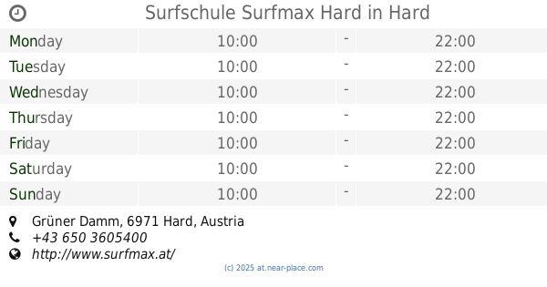
Surfschule Surfmax Hard
Grüner Damm, Hard
Lodging
read more
1.514 km
Junges Hotel Hard
Allmendstraße 87, Hard
Lodging
read more
1.666 km
Gasthof Schendlingen
Schendlingerstraße 32, Bregenz
Lodging
read more
1.712 km
Kloster Mehrerau
Seglerweg 1, Bregenz
Lodging
read more
1.794 km
Gasthaus Zur Post Inh Veronika Horaschek
Unterfeldstraße 8, Hard
Lodging
read more
1.827 km
Hotel Garni Matte
Wuhrbaumweg 36, Bregenz
Lodging
read more
1.827 km
Hotel Garni Matt
Wuhrbaumweg 36, Bregenz
Lodging
read more
1.854 km
Villa Viva | Pension - Apartment
Rheinstraße 46, Bregenz
Lodging
read more
2.109 km
Hotel-Gasthof Lamm
Mehrerauerstraße 51, Bregenz
Lodging
read more
2.7 km
Urlaub in Bregenz
Merbodgasse 6, Bregenz
Lodging
read more
📑
all categories
Accounting
Administrative area level 1
Administrative area level 2
Airport
Amusement park
Aquarium
Art gallery
Atm
Bakery
Bank
Bar
Beauty salon
Bicycle store
Book store
Bowling alley
Bus station
Cafe
Campground
Car dealer
Car rental
Car repair
Car wash
Casino
Cemetery
Church
City hall
Clothing store
Colloquial area
Convenience store
Country
Courthouse
Dentist
Department store
Doctor
Electrician
Electronics store
Embassy
Finance
Fire station
Florist
Food
Funeral home
Furniture store
Gas station
General contractor
Grocery or supermarket
Gym
Hair care
Hardware store
Health
Hindu Temple
Home goods store
Hospital
Insurance agency
Jewelry store
Laundry
Lawyer
Library
Light rail station
Liquor store
Local government office
Locality
Locksmith
Lodging
Meal delivery
Meal takeaway
Mosque
Movie rental
Movie theater
Moving company
Museum
Natural feature
Neighborhood
Night club
Painter
Park
Parking
Pet store
Pharmacy
Physiotherapist
Place of worship
Plumber
Point of interest
Police
Political
Post office
Premise
Real estate agency
Restaurant
Roofing contractor
Route
Rv park, camping
School
Shoe store
Shopping mall
Spa
Stadium
Storage
Store
Subpremise
Subway station
Supermarket
Synagogue
Taxi stand
Train station
Transit station
Travel agency
University
Veterinary care
Zoo
administrative area level 3
sublocality level 1
↑