Lodging nearby Haus Fink
Austria
Lodging nearby Haus Fink
Haus Fink
3a, Gsetzbichlweg, 6080, Innsbruck, Innsbruck, AT Austria
contacts phone
:
+43 664 73284114
website:
haus-fink.weebly.com
Latitude:
47.2302371
, Longitude:
11.4029184
larger map & directions
read more
nearest Lodging
136 m
Haus Martha
Gsetzbichlweg 20, Innsbruck
Lodging
read more
173 m
Hotel Sonnenhof, Bed & Breakfast & Appartements
Fernkreuzweg 16, Igls
Lodging
read more
259 m
Pension Gstrein Inh Edgar Gstrein
Pertingerweg 5, Innsbruck
Lodging
read more
260 m
Haus Panorama
Pertingerweg 8, Innsbruck
Lodging
read more
400 m
Ferienwohnung-Apartment Monika in Innsbruck-Igls
Hilberstraße 2, Innsbruck
Lodging
read more
410 m
Beck Hotels Igls GmbH & Co KG
Viller Steig 2, Kurort Igls
Lodging
read more
451 m
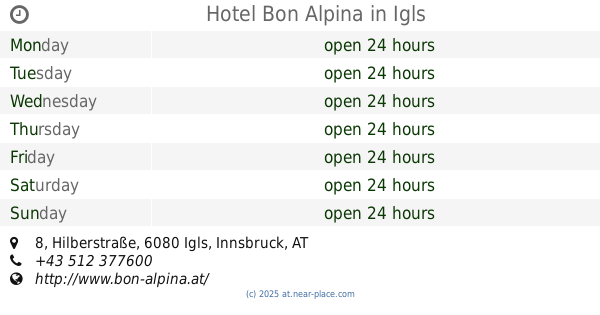
Hotel Bon Alpina
Hilberstraße 8, Igls
Lodging
read more
455 m
Bah Hotelanlagen AG
Hilberstraße 8, Innsbruck-Igls
Lodging
read more
524 m
Gasthof-Pension Turmbichl
Lilly-von-Sauter-Weg 4, Innsbruck
Lodging
read more
601 m
Sporthotel Igls
Hilberstraße 17, Innsbruck
Lodging
read more
606 m
Ägidihof
Bilgeristraße 1, Innsbruck
Lodging
read more
613 m
Anna Weber
Bilgeristraße 1, Igls
Lodging
read more
659 m
Haus Angelika bed&breakfast Innsbruck-Igls
D'Albert-Weg 5, Innsbruck
Lodging
read more
659 m
Apartment Gisi
Bilgeristraße 12 a Etage 2, Igls
Lodging
read more
659 m
Appartement Luiggi
Bilgeristraße 12, Innsbruck
Lodging
read more
684 m
Appartement Dido
12a, Bilgeristraße, Innsbruck
Lodging
read more
805 m
Hotel-Restaurant Batzenhäusl
Lanser Straße 12, Igls
Lodging
read more
817 m
RB Hotelbetriebs AG
Lanser Straße 12, Innsbruck
Lodging
read more
823 m
Hotel Eagles Inn
Lanser Straße 12, Igls
Lodging
read more
823 m
Eagles Astoria Hotel
Lanser Straße 12, Igls
Lodging
read more
850 m
奥地利
A-, Badhausstraße 1, Innsbruck
Lodging
read more
979 m
Hotel Gruberhof Igls-Innsbruck
Heiligwasserweg 12, Innsbruck
Lodging
read more
1.013 km
www.innsbruck-hostel.com
Heiligwasserweg 10, Innsbruck
Lodging
read more
1.334 km
Romedihof
Lanser Straße 60, Innsbruck
Lodging
read more
1.853 km
Patscherkofel Schutzhaus
Kochholzweg 158, Lans
Lodging
read more
📑
all categories
Accounting
Administrative area level 1
Administrative area level 2
Airport
Amusement park
Aquarium
Art gallery
Atm
Bakery
Bank
Bar
Beauty salon
Bicycle store
Book store
Bowling alley
Bus station
Cafe
Campground
Car dealer
Car rental
Car repair
Car wash
Casino
Cemetery
Church
City hall
Clothing store
Colloquial area
Convenience store
Country
Courthouse
Dentist
Department store
Doctor
Electrician
Electronics store
Embassy
Finance
Fire station
Florist
Food
Funeral home
Furniture store
Gas station
General contractor
Grocery or supermarket
Gym
Hair care
Hardware store
Health
Hindu Temple
Home goods store
Hospital
Insurance agency
Jewelry store
Laundry
Lawyer
Library
Light rail station
Liquor store
Local government office
Locality
Locksmith
Lodging
Meal delivery
Meal takeaway
Mosque
Movie rental
Movie theater
Moving company
Museum
Natural feature
Neighborhood
Night club
Painter
Park
Parking
Pet store
Pharmacy
Physiotherapist
Place of worship
Plumber
Point of interest
Police
Political
Post office
Premise
Real estate agency
Restaurant
Roofing contractor
Route
Rv park, camping
School
Shoe store
Shopping mall
Spa
Stadium
Storage
Store
Subpremise
Subway station
Supermarket
Synagogue
Taxi stand
Train station
Transit station
Travel agency
University
Veterinary care
Zoo
administrative area level 3
sublocality level 1
↑