Parking nearby Hagenstraße 57 Garage
Austria
Parking nearby Hagenstraße 57 Garage
Hagenstraße 57 Garage
Hagenstraße 57, Linz Østrig
contacts phone
:
+43
Latitude:
48.3110504
, Longitude:
14.2694907
read more
nearest Parking
407 m
Windflachweg 1 Parking
Hohe Straße 63, Linz
Parking
read more
831 m
Parkgarage Grünmarkt
Kaarstraße 13s, Linz
Parking
read more
927 m
Margarethen 17 Parking
Margarethen 17, Linz
Parking
read more
964 m
Tiefgarage Neues Rathaus
Ottensheimer Straße 26, Linz
Parking
read more
1.02 km
Römerstraße 26 Parking
Römerstraße 26, Linz
Parking
read more
1.042 km
Parkplatz Petrinum
Parkplatz Petrinum,4040, Linz
Parking
read more
1.111 km
Donaugarage GmbH
Obere Donaulände 17, Linz
Parking
read more
1.237 km
Lessingstraße 13 Parking
Lessingstraße 13, Linz
Parking
read more
1.278 km
Parkplatz
Wildbergstraße 28, Linz
Parking
read more
1.279 km
Garage Promenade Linz
Promenade, Linz
Parking
read more
1.357 km
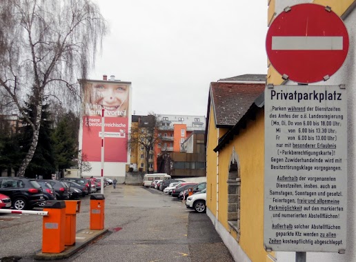
Privatparkplatz der o.ö. Landesregierung
Klammstraße 20a, Linz
Parking
read more
1.531 km
Untere Donaulände 16s Parking
Untere Donaulände 16s, Linz
Parking
read more
1.551 km
Garage Pfarrplatz
Pfarrplatz 9, Linz
Parking
read more
1.591 km
Dom-Hotel City
Baumbachstraße 17, Linz
Parking
read more
1.615 km
Parkplatz
Linz
Parking
read more
1.624 km
Beurleweg Parking
Beurleweg, Linz
Parking
read more
1.628 km
Parkplatz Pöstlingberg Schlössl
Am Pöstlingberg 15, Linz
Parking
read more
1.732 km
Brothers Mauracher Domgarage GmbH
Stifterstraße 21, Linz
Parking
read more
1.732 km
Gebrüder Mauracher Domgarage GmbH
Stifterstraße 21, Linz
Parking
read more
1.77 km
Parkgarage
Hopfengasse 23, Linz
Parking
read more
1.852 km
Ferihumerstr.
Ferihumerstraße, Linz
Parking
read more
1.911 km
Lidl Tiefgarage
Lederergasse 23, Linz
Parking
read more
1.976 km
Kaisergasse 33 Parking
Kaisergasse 33, Linz
Parking
read more
2.089 km
Mozartstraße 22 Parking
Mozartstraße 20, Linz
Parking
read more
2.256 km
Schillerpl. Garage
Schillerplatz, Linz
Parking
read more
📑
all categories
Accounting
Administrative area level 1
Administrative area level 2
Airport
Amusement park
Aquarium
Art gallery
Atm
Bakery
Bank
Bar
Beauty salon
Bicycle store
Book store
Bowling alley
Bus station
Cafe
Campground
Car dealer
Car rental
Car repair
Car wash
Casino
Cemetery
Church
City hall
Clothing store
Colloquial area
Convenience store
Country
Courthouse
Dentist
Department store
Doctor
Electrician
Electronics store
Embassy
Finance
Fire station
Florist
Food
Funeral home
Furniture store
Gas station
General contractor
Grocery or supermarket
Gym
Hair care
Hardware store
Health
Hindu Temple
Home goods store
Hospital
Insurance agency
Jewelry store
Laundry
Lawyer
Library
Light rail station
Liquor store
Local government office
Locality
Locksmith
Lodging
Meal delivery
Meal takeaway
Mosque
Movie rental
Movie theater
Moving company
Museum
Natural feature
Neighborhood
Night club
Painter
Park
Parking
Pet store
Pharmacy
Physiotherapist
Place of worship
Plumber
Point of interest
Police
Political
Post office
Premise
Real estate agency
Restaurant
Roofing contractor
Route
Rv park, camping
School
Shoe store
Shopping mall
Spa
Stadium
Storage
Store
Subpremise
Subway station
Supermarket
Synagogue
Taxi stand
Train station
Transit station
Travel agency
University
Veterinary care
Zoo
administrative area level 3
sublocality level 1
↑