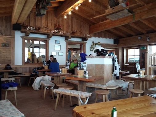
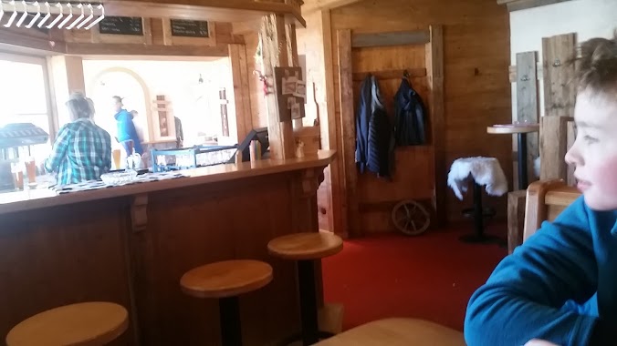
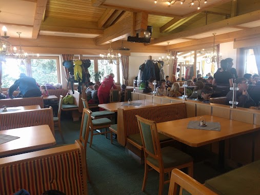
Restaurant nearby Gipfelalm Hohe Salve
Austria
Restaurant nearby Gipfelalm Hohe Salve
Gipfelalm Hohe Salve
Gemeinde Westendorf Austria
contacts phone
:
+43
Latitude:
47.4653246
, Longitude:
12.2038965
read more
nearest Restaurant
616 m
Stoagrubn Hütte
Innersalvenberg 53, Salvenberg
Restaurant
read more
770 m
Skihütte Keatalm
Salvenberg 35, Söll
Restaurant
read more
960 m
Alpengasthof Rigi
Außersalvenberg 51, Salvenberg
Restaurant
read more
1.308 km
Alpengasthof Salvenalm
Innersalvenberg 42a, Hopfgarten
Restaurant
read more
1.324 km
Filzalm Jausenstation
Filz 24, Sonnberg
Restaurant
read more
1.952 km
Skiwelt - Hütte
Filz 1, Brixen im Thale
Restaurant
read more
2.241 km
Brantl Alm
Oberer Sonnberg 82, Brixen im Thale
Restaurant
read more
2.243 km
Brantlalm
Brixen im Thale
Restaurant
read more
2.622 km
Sunnseit Hütte
Innersalvenberg 1a, Salvenberg
Restaurant
read more
2.769 km
Köpflinghof
Bromberg 22
Restaurant
read more
3.082 km
Gasthaus Holzalm
Zinsberg 16, Sonnberg
Restaurant
read more
3.112 km
Premium Küche
com, mittersill_kebab@hotmail, Mittersill
Restaurant
read more
3.452 km
Brixner Stadl
Liftweg 2, Brixen im Thale
Restaurant
read more
3.466 km
Aualm
Bromberg 36, Söll
Restaurant
read more
3.571 km
Biwak
Zinsberg 4a, Sonnberg
Restaurant
read more
3.602 km
Reiterstüberl
Bichlinger Straße 100, Bichling
Restaurant
read more
3.783 km
Dorfstüberl
Dorfstraße 2, Westendorf
Restaurant
read more
3.807 km
Kebap & Pizza
6361, Hopfgarten-Markt
Restaurant
read more
3.906 km
Restaurant Salvena Pizzaria
Brixentaler Straße 41
Restaurant
read more
4.1 km
Sunseitdirndler
Bromberg 34c, Söll
Restaurant
read more
4.29 km
Skihütte Marchental
Bromberg 35a, Söll
Restaurant
read more
4.416 km
Bergrestaurant Brandstadl
Schwarzach 2, Scheffau am Wilden Kaiser
Restaurant
read more
4.473 km
Tanzbodenalm Gastronomie GmbH
Bromberg 35a, Söll
Restaurant
read more
4.544 km
The Campers
Badhausweg 9
Restaurant
read more
4.891 km
Berggasthof Kandleralm
Kandleralmweg 1, Brixen im Thale
Restaurant
read more
📑
all categories
Accounting
Administrative area level 1
Administrative area level 2
Airport
Amusement park
Aquarium
Art gallery
Atm
Bakery
Bank
Bar
Beauty salon
Bicycle store
Book store
Bowling alley
Bus station
Cafe
Campground
Car dealer
Car rental
Car repair
Car wash
Casino
Cemetery
Church
City hall
Clothing store
Colloquial area
Convenience store
Country
Courthouse
Dentist
Department store
Doctor
Electrician
Electronics store
Embassy
Finance
Fire station
Florist
Food
Funeral home
Furniture store
Gas station
General contractor
Grocery or supermarket
Gym
Hair care
Hardware store
Health
Hindu Temple
Home goods store
Hospital
Insurance agency
Jewelry store
Laundry
Lawyer
Library
Light rail station
Liquor store
Local government office
Locality
Locksmith
Lodging
Meal delivery
Meal takeaway
Mosque
Movie rental
Movie theater
Moving company
Museum
Natural feature
Neighborhood
Night club
Painter
Park
Parking
Pet store
Pharmacy
Physiotherapist
Place of worship
Plumber
Point of interest
Police
Political
Post office
Premise
Real estate agency
Restaurant
Roofing contractor
Route
Rv park, camping
School
Shoe store
Shopping mall
Spa
Stadium
Storage
Store
Subpremise
Subway station
Supermarket
Synagogue
Taxi stand
Train station
Transit station
Travel agency
University
Veterinary care
Zoo
administrative area level 3
sublocality level 1
↑