Store nearby Fressnapf
Austria
Store nearby Fressnapf
Fressnapf
Vienna Østrig
contacts phone
:
+43
Latitude:
48.2443345
, Longitude:
16.4607396
read more
nearest Store
18 m
LIBRO
EKZ Gewerbepark Stadtlau,, Gewerbeparkstraße 12, Wien
Store
read more
30 m
Conrad Megastore Vienna Stadlau
Gewerbepark Stadlau, Gewerbeparkstraße 12, Wien
Store
read more
31 m
Fleisch und Selchwaren
Gewerbepark Stadlau, Gewerbeparkstraße 12, Wien
Store
read more
109 m
Das Futterhaus
Vienna
Store
read more
124 m
dm drogerie markt GmbH
Gewerbeparkstraße 21, Wien
Store
read more
581 m
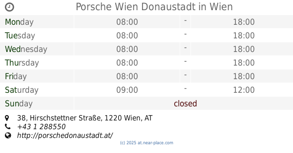
Porsche Wien Donaustadt
Hirschstettner Straße 38, Wien
Store
read more
835 m
GHS-Gastrohausservice
Polgarstrasse 32/3/2, Wien
Store
read more
847 m
BAUSTOFFE KAGRAN Edinger & Co. KG
Am langen Felde 59, Wien
Store
read more
1.215 km
B+M Newtec
Hosnedlgasse 6, Wien
Store
read more
1.365 km
Trafik Cigarrenfachgeschäft Matzinger
Kagraner Platz 51, Wien
Store
read more
1.422 km
Tabak Trafik / Inh. Elham Rezk
Wagramer Straße 142, Wien
Store
read more
1.437 km
LA CASSETTA Wohnen & Geschenke
Siebenbürgerstraße 9, Wien
Store
read more
1.441 km
B.I.Tech.Legat
Rugierstraße 6, Wien
Store
read more
1.463 km
Hörgeräte Pachmann GmbH
Wagramer Straße 133, Wien
Store
read more
1.556 km
Teamsport Zens
Gumplowiczstr. 3, Wien
Store
read more
1.608 km
Wolfgang Stummer
Siebenbürgerstraße 4, Wien
Store
read more
1.686 km
wiensport.at
Erzherzog-Karl-Straße 98, Wien
Store
read more
1.704 km
CCA Camping- und Caravaning Club Austria
Donaustadtstraße 34, Wien
Store
read more
1.887 km
Ponticello
Wagramer Straße 81, Wien
Store
read more
1.918 km
Qbo Coffee (in Tchibo Filiale)
Wagramer Str. 81, Donauzentrum II, Top 113a, Wien
Store
read more
1.919 km
Meine Eisträumerei
Wagramer Straße 81, Wien
Store
read more
1.919 km
Lego Prodavnica
Wagramer Straße 81, Wien
Store
read more
1.96 km
Tretrollerverkauf.at
Industriestraße 4, Wien
Store
read more
2.02 km
Seat Schwandl
Erzherzog-Karl-Straße 21, Wien
Store
read more
2.57 km
OBSTGENUSS
Industriestraße 70, Wien
Store
read more
📑
all categories
Accounting
Administrative area level 1
Administrative area level 2
Airport
Amusement park
Aquarium
Art gallery
Atm
Bakery
Bank
Bar
Beauty salon
Bicycle store
Book store
Bowling alley
Bus station
Cafe
Campground
Car dealer
Car rental
Car repair
Car wash
Casino
Cemetery
Church
City hall
Clothing store
Colloquial area
Convenience store
Country
Courthouse
Dentist
Department store
Doctor
Electrician
Electronics store
Embassy
Finance
Fire station
Florist
Food
Funeral home
Furniture store
Gas station
General contractor
Grocery or supermarket
Gym
Hair care
Hardware store
Health
Hindu Temple
Home goods store
Hospital
Insurance agency
Jewelry store
Laundry
Lawyer
Library
Light rail station
Liquor store
Local government office
Locality
Locksmith
Lodging
Meal delivery
Meal takeaway
Mosque
Movie rental
Movie theater
Moving company
Museum
Natural feature
Neighborhood
Night club
Painter
Park
Parking
Pet store
Pharmacy
Physiotherapist
Place of worship
Plumber
Point of interest
Police
Political
Post office
Premise
Real estate agency
Restaurant
Roofing contractor
Route
Rv park, camping
School
Shoe store
Shopping mall
Spa
Stadium
Storage
Store
Subpremise
Subway station
Supermarket
Synagogue
Taxi stand
Train station
Transit station
Travel agency
University
Veterinary care
Zoo
administrative area level 3
sublocality level 1
↑