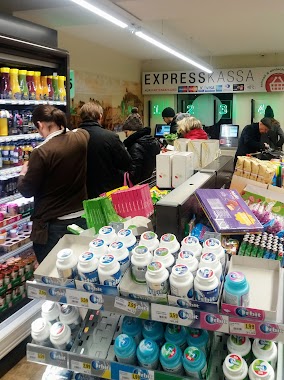
Supermarket nearby SPAR
Austria
Supermarket nearby SPAR
SPAR
34, Zinzendorfgasse, 8010, Graz, Graz, AT Österreich
contacts phone
:
+43 316 322646
website:
www.spar.at
Latitude:
47.0760147
, Longitude:
15.4503916
larger map & directions
read more
nearest Supermarket
563 m
SPAR
Maiffredygasse 8, Graz
Supermarket
read more
563 m
SPAR Cornelia Mospointner-Gal e.U.
Maiffredygasse 8, Graz
Supermarket
read more
632 m
SPAR Wolfgang Gössl e.U.
Humboldtstraße 37, Graz
Supermarket
read more
637 m
SPAR
Leonhardstraße 95, Graz
Supermarket
read more
734 m
BILLA AG
Körblergasse 27, Graz
Supermarket
read more
745 m
BILLA AG
SPARBERSBACHG 65-67A, Graz
Supermarket
read more
915 m
SPAR
Elisabethstraße 80, Graz
Supermarket
read more
954 m
SPAR Koller Jürgen
Rechbauerstraße 38, Graz
Supermarket
read more
973 m
Reformstark Martin
14, Sporgasse 12, Graz
Supermarket
read more
982 m
Biofeld
Elisabethstraße 84, Graz
Supermarket
read more
982 m
SPAR
Hans-Sachs-Gasse 14, Graz
Supermarket
read more
986 m
아시안 마켓. 김치 라면 등
Opernring 22, Graz
Supermarket
read more
1.013 km
's Fachl - der Kreativ- Design- Schmankerlshop
Herrengasse 13, Graz
Supermarket
read more
1.05 km
SPAR Michael Prieler
Hauptplatz 30, Oberwölz Stadt
Supermarket
read more
1.066 km
BILLA AG
Jakominiplatz 12, Graz
Supermarket
read more
1.104 km
Mag. Michael Petz
Jakominiplatz 1, Graz
Supermarket
read more
1.126 km
BILLA AG
Hauptplatz 3, Graz
Supermarket
read more
1.133 km
BILLA AG
Hilmgasse 4, Graz
Supermarket
read more
1.273 km
Das Dekagramm - Der verpackungsfreie Erlebnissupermarkt
Joanneumring 16, Graz
Supermarket
read more
1.303 km
Feinkost M. & H. Langer
Kaiserfeldgasse 22, Graz
Supermarket
read more
1.384 km
HOFER
Lendkai 59, Graz
Supermarket
read more
1.763 km
BILLA AG
Waltendorfer Hauptstraße 26, Graz
Supermarket
read more
1.768 km
SPAR
Moserhofgasse 42, Graz
Supermarket
read more
2.504 km
Spar
Lazarettgürtel 55, Graz
Supermarket
read more
2.504 km
INTERSPAR
Lazarettgürtel 55, Graz
Supermarket
read more
📑
all categories
Accounting
Administrative area level 1
Administrative area level 2
Airport
Amusement park
Aquarium
Art gallery
Atm
Bakery
Bank
Bar
Beauty salon
Bicycle store
Book store
Bowling alley
Bus station
Cafe
Campground
Car dealer
Car rental
Car repair
Car wash
Casino
Cemetery
Church
City hall
Clothing store
Colloquial area
Convenience store
Country
Courthouse
Dentist
Department store
Doctor
Electrician
Electronics store
Embassy
Finance
Fire station
Florist
Food
Funeral home
Furniture store
Gas station
General contractor
Grocery or supermarket
Gym
Hair care
Hardware store
Health
Hindu Temple
Home goods store
Hospital
Insurance agency
Jewelry store
Laundry
Lawyer
Library
Light rail station
Liquor store
Local government office
Locality
Locksmith
Lodging
Meal delivery
Meal takeaway
Mosque
Movie rental
Movie theater
Moving company
Museum
Natural feature
Neighborhood
Night club
Painter
Park
Parking
Pet store
Pharmacy
Physiotherapist
Place of worship
Plumber
Point of interest
Police
Political
Post office
Premise
Real estate agency
Restaurant
Roofing contractor
Route
Rv park, camping
School
Shoe store
Shopping mall
Spa
Stadium
Storage
Store
Subpremise
Subway station
Supermarket
Synagogue
Taxi stand
Train station
Transit station
Travel agency
University
Veterinary care
Zoo
administrative area level 3
sublocality level 1
↑