Cafe nearby Cafe-Bar Plateau
Austria
Cafe nearby Cafe-Bar Plateau
Cafe-Bar Plateau
51, Ingenieur-Etzel-Straße, 6020, Innsbruck, Innsbruck, AT Austria
contacts phone
:
+43 512 585334
Latitude:
47.2707449
, Longitude:
11.4042011
larger map & directions
read more
nearest Cafe
588 m
Cafe Platzl
Amraser Straße 1, Innsbruck
Cafe
read more
616 m
Alpin Park Hotel
Pradler Straße 28, Innsbruck
Cafe
read more
635 m
Cafe Atrium
Meinhardstraße 3, Innsbruck
Cafe
read more
720 m
Le Cafe
Pradler Straße 38, Innsbruck
Cafe
read more
751 m
Cafe City, Gebrüder Murauer GmbH
Meinhardstraße 16, Innsbruck
Cafe
read more
807 m
Strudel Cafe Kroll
Hofgasse 6, Innsbruck
Cafe
read more
813 m
Gelateria Tomaselli
Hofgasse 5, Innsbruck
Cafe
read more
814 m
Café Central
Gilmstraße 5, Innsbruck
Cafe
read more
815 m
Café-Club Filou
Stiftgasse 12, Innsbruck
Cafe
read more
830 m
Wendlstube
Gumppstraße 1, Innsbruck
Cafe
read more
832 m
Dom Cafe-Bar
Pfarrgasse 3 6020 Innsbruck
Cafe
read more
868 m
Cafe Bistro Mieze Schindler
Herzog-Friedrich-Straße 31, Innsbruck
Cafe
read more
880 m
Aqua Boulevard Cafe
Maria-Theresien-Straße 3, Innsbruck
Cafe
read more
881 m
Loacker Store
Innsbruck
Cafe
read more
884 m
Testa Rossa
Hauptbahnhof Unterführung, Innsbruck
Cafe
read more
907 m
Loacker Store
Sparkassenplatz 5, Innsbruck
Cafe
read more
918 m
Cafe Inn Cognito
Seilergasse 5, Innsbruck
Cafe
read more
919 m
Dolce Voko
Maria-Theresien-Straße 31, Innsbruck
Cafe
read more
920 m
Cafe-Bar Ischia
Seilergasse 4, Innsbruck
Cafe
read more
920 m
Cafe Bianka
Pradler Straße 78, Innsbruck
Cafe
read more
1.019 km
Cafe & Pub Hokus Pokus
Marktgraben 2, Innsbruck
Cafe
read more
1.042 km
Cafe Okay
Adamgasse 13, Innsbruck
Cafe
read more
1.042 km
Cafe Tyrol
Roseggerstraße 2, Innsbruck
Cafe
read more
1.112 km
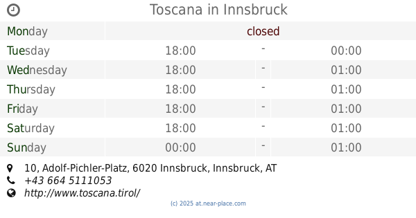
Toscana
Adolf-Pichler-Platz 10, Innsbruck
Cafe
read more
1.398 km
Cafe Royal Bar
Andreas-Hofer-Straße 4, Innsbruck
Cafe
read more
📑
all categories
Accounting
Administrative area level 1
Administrative area level 2
Airport
Amusement park
Aquarium
Art gallery
Atm
Bakery
Bank
Bar
Beauty salon
Bicycle store
Book store
Bowling alley
Bus station
Cafe
Campground
Car dealer
Car rental
Car repair
Car wash
Casino
Cemetery
Church
City hall
Clothing store
Colloquial area
Convenience store
Country
Courthouse
Dentist
Department store
Doctor
Electrician
Electronics store
Embassy
Finance
Fire station
Florist
Food
Funeral home
Furniture store
Gas station
General contractor
Grocery or supermarket
Gym
Hair care
Hardware store
Health
Hindu Temple
Home goods store
Hospital
Insurance agency
Jewelry store
Laundry
Lawyer
Library
Light rail station
Liquor store
Local government office
Locality
Locksmith
Lodging
Meal delivery
Meal takeaway
Mosque
Movie rental
Movie theater
Moving company
Museum
Natural feature
Neighborhood
Night club
Painter
Park
Parking
Pet store
Pharmacy
Physiotherapist
Place of worship
Plumber
Point of interest
Police
Political
Post office
Premise
Real estate agency
Restaurant
Roofing contractor
Route
Rv park, camping
School
Shoe store
Shopping mall
Spa
Stadium
Storage
Store
Subpremise
Subway station
Supermarket
Synagogue
Taxi stand
Train station
Transit station
Travel agency
University
Veterinary care
Zoo
administrative area level 3
sublocality level 1
↑