Bar nearby Magdalenal
Austria
Bar nearby Magdalenal
Magdalenal
Griesmayrstraße 18, Linz Austria
contacts phone
:
+43
Latitude:
48.3335751
, Longitude:
14.3001916
read more
nearest Bar
13 m
Weinstadl Urfahr
Griesmayrstraße 18, Linz
Bar
read more
811 m
Memorie Pub
Bachl Gründberg, Linz
Bar
read more
955 m
Buffet Auer
Leonfeldner Straße 97, Linz
Bar
read more
955 m
Buffet Auer
Leonfeldner Str. 97, Linz
Bar
read more
969 m
Wirtschaftshilfe der Studierenden Oberösterreich
Johann-Wilhelm-Klein-Straße 70-72, Linz
Bar
read more
1.032 km
Gasthaus Limberger
Am Anger, Blindwiesen 5, Linz
Bar
read more
1.398 km
Relax Music Pub
Freistädter Straße 307, Linz
Bar
read more
1.405 km
Cafe-Pub Strawanzer
Freistädter Straße 307, Linz
Bar
read more
1.41 km
Relax Bar Lounge
Linz, Freistädterstrasse
Bar
read more
1.416 km
RELAX Bar | Lounge
Freistädter Straße 307, Linz
Bar
read more
1.667 km
LUI - Linzer Uni Inn
Altenbergerstraße 69, Linz
Bar
read more
1.721 km
Malaya Gastro GmbH
Leonfeldner Straße 322, Linz
Bar
read more
1.743 km
Bierstudent
Altenbergerstraße 70, Linz
Bar
read more
1.783 km
Science Cafe
Bauteil 2, Altenbergerstraße 69, Linz
Bar
read more
1.817 km
Fiakerstüberl
Leonfeldner Straße 38, Linz
Bar
read more
1.862 km
Gallanderstüberl
Gallanderstraße 3, Linz
Bar
read more
2.179 km
Oldie Musik Beisl
Leonfeldner Straße 1, Linz
Bar
read more
2.482 km
CASTELLO DEL VINO Lentia City
Blütenstraße 15, Linz
Bar
read more
2.522 km
KÉ café & bar
Untere Donaulände 9, Linz
Bar
read more
2.649 km
Cheers
Hauptstraße 42, Linz
Bar
read more
2.794 km
ADMIRAL Filiale
Rudolfstraße 4-6, Linz
Bar
read more
3.005 km
Sisi-Top
Untere Donaulände 8, Linz
Bar
read more
3.067 km
Shisha Barlast
Paul-Hahn-Straße 5, Linz
Bar
read more
3.137 km
Leopoldistüberl der Beer Buddies Brewing Company
Adlergasse 6, Linz
Bar
read more
3.249 km
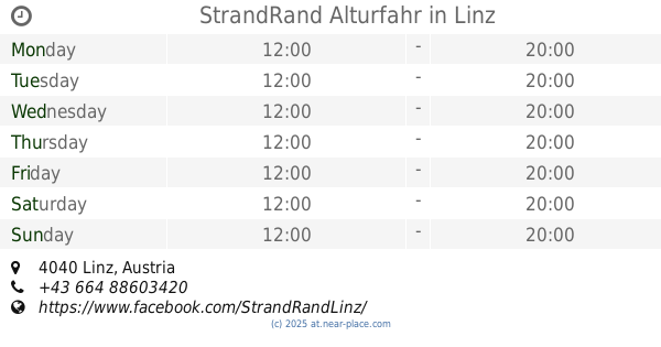
StrandRand Alturfahr
Linz
Bar
read more
📑
all categories
Accounting
Administrative area level 1
Administrative area level 2
Airport
Amusement park
Aquarium
Art gallery
Atm
Bakery
Bank
Bar
Beauty salon
Bicycle store
Book store
Bowling alley
Bus station
Cafe
Campground
Car dealer
Car rental
Car repair
Car wash
Casino
Cemetery
Church
City hall
Clothing store
Colloquial area
Convenience store
Country
Courthouse
Dentist
Department store
Doctor
Electrician
Electronics store
Embassy
Finance
Fire station
Florist
Food
Funeral home
Furniture store
Gas station
General contractor
Grocery or supermarket
Gym
Hair care
Hardware store
Health
Hindu Temple
Home goods store
Hospital
Insurance agency
Jewelry store
Laundry
Lawyer
Library
Light rail station
Liquor store
Local government office
Locality
Locksmith
Lodging
Meal delivery
Meal takeaway
Mosque
Movie rental
Movie theater
Moving company
Museum
Natural feature
Neighborhood
Night club
Painter
Park
Parking
Pet store
Pharmacy
Physiotherapist
Place of worship
Plumber
Point of interest
Police
Political
Post office
Premise
Real estate agency
Restaurant
Roofing contractor
Route
Rv park, camping
School
Shoe store
Shopping mall
Spa
Stadium
Storage
Store
Subpremise
Subway station
Supermarket
Synagogue
Taxi stand
Train station
Transit station
Travel agency
University
Veterinary care
Zoo
administrative area level 3
sublocality level 1
↑