Gas station nearby DISK Tankstelle
Austria
Gas station nearby DISK Tankstelle
DISK Tankstelle
Bundesstraße 97, Lauterach Austria
contacts phone
:
+43
Latitude:
47.470247
, Longitude:
9.728809
read more
nearest Gas station
1.269 km
Eni
Bundesstraße 18, Lauterach
Gas station
read more
1.739 km
Bautrans GmbH Tankstelle
Senderstraße 16, Wolfurt
Gas station
read more
1.809 km
eni ServiceStation
Achstraße 39, Wolfurt
Gas station
read more
1.977 km
OMV Tankstelle
Arlbergstraße 135, Bregenz
Gas station
read more
2.662 km
OMV Tankstelle
Dornbirner Straße 22, Wolfurt
Gas station
read more
2.788 km
Diskont Tankstelle
Rauhholzstraße 29, Hard
Gas station
read more
2.799 km
Agip
Arlbergstraße 54, Bregenz
Gas station
read more
2.799 km
Eni
Arlbergstraße 54, Bregenz
Gas station
read more
2.802 km
Eni Austria GmbH
Arlbergstraße 54, Bregenz
Gas station
read more
2.837 km
Günther Praxmarer
Arlbergstraße 54, Bregenz
Gas station
read more
2.855 km
Eni
Rheinstraße 20, Hard
Gas station
read more
2.899 km
OMV Tankstelle
Rheinstraße 24, Hard
Gas station
read more
2.928 km
Shell
Rheinstraße 88, Bregenz
Gas station
read more
2.961 km
BP
Arlbergstraße 63, Bregenz
Gas station
read more
2.971 km
Avanti Tankstelle
Hofsteigstraße 85, Hard
Gas station
read more
3.182 km
Eni
Rheinstraße 4, Bregenz
Gas station
read more
3.792 km
JET Tankstelle
Rheinstraße 99, Hard
Gas station
read more
3.802 km
Jet
Rheinstraße 99, Hard
Gas station
read more
4.2 km
Tankstelle
Hofsteigstraße 114-120, Dornbirn
Gas station
read more
4.582 km
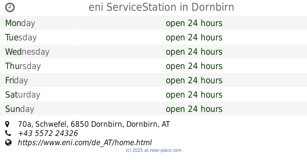
eni ServiceStation
Schwefel 70a, Dornbirn
Gas station
read more
4.763 km
OMV Tankstelle
Schwefel 53, Dornbirn
Gas station
read more
4.933 km
JET Tankstelle
Schwefel 44a, Dornbirn
Gas station
read more
4.935 km
Jet
Schwefel 44a, Dornbirn
Gas station
read more
5.051 km
Shell
Schwefel 40, Dornbirn
Gas station
read more
5.35 km
OMV Tankstelle
Hagstraße 27, Lustenau
Gas station
read more
📑
all categories
Accounting
Administrative area level 1
Administrative area level 2
Airport
Amusement park
Aquarium
Art gallery
Atm
Bakery
Bank
Bar
Beauty salon
Bicycle store
Book store
Bowling alley
Bus station
Cafe
Campground
Car dealer
Car rental
Car repair
Car wash
Casino
Cemetery
Church
City hall
Clothing store
Colloquial area
Convenience store
Country
Courthouse
Dentist
Department store
Doctor
Electrician
Electronics store
Embassy
Finance
Fire station
Florist
Food
Funeral home
Furniture store
Gas station
General contractor
Grocery or supermarket
Gym
Hair care
Hardware store
Health
Hindu Temple
Home goods store
Hospital
Insurance agency
Jewelry store
Laundry
Lawyer
Library
Light rail station
Liquor store
Local government office
Locality
Locksmith
Lodging
Meal delivery
Meal takeaway
Mosque
Movie rental
Movie theater
Moving company
Museum
Natural feature
Neighborhood
Night club
Painter
Park
Parking
Pet store
Pharmacy
Physiotherapist
Place of worship
Plumber
Point of interest
Police
Political
Post office
Premise
Real estate agency
Restaurant
Roofing contractor
Route
Rv park, camping
School
Shoe store
Shopping mall
Spa
Stadium
Storage
Store
Subpremise
Subway station
Supermarket
Synagogue
Taxi stand
Train station
Transit station
Travel agency
University
Veterinary care
Zoo
administrative area level 3
sublocality level 1
↑